


Basics
- Length:
- 29 miles (46 km)
Description
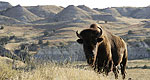
From the Killdeer Mountains to the deeply entrenched Little Missouri breaks and badlands, this byway provides a unique and enchanting landscape in one of the most scenic areas of western North Dakota. The rich culture and history of the Mandan, Hidatsa, and Arikara tribes paired with the recreational opportunities of Little Missouri State Park provide travelers with an enthralling adventure in west central North Dakota.
Tourism Resources
Helpful Links
Tourism Resources
Points of Interest
Points of Interest Along The Way
Crow Flies High Butte Overlook (ND)
This butte offers stunning view of Lake Sakakawea and the Four Bears Bridge.
Directions
To get to Crow Flies High Butte Overlook, take Highway 22 to the northern end of the byway and continue along until you reach a T" in the road. Turn right (east) onto highway 23 and the overlook will be about twelve miles down, just outside of New Town.
Four Bears Museum (ND)
This diverse museum near New Town on the Fort Berthold Indian Reservation offers a cultural and historic overview of the Mandan, Hidatsa, and Arikara tribes.
Directions
To get to Four Bears Museum from the byway, take Highway 22 to the north end of the byway and continue on this road until you come to a T" in the road. Turn right (east) onto Highway 23; the museum is about ten miles down the road.
"Killdeer Battlefield State Historic Site (ND)
This site commemorates a battle fought on July 28, 1864 between troops commanded by General Alfred Sully and Sioux Indians. Sully's force had been sent into the Dakota's territory to develop routes to western gold fields and also to punish those Indians who had participated in Minnesota's Dakota Conflict of 1862. Many of the Sioux groups gathered at Killdeer Mountain had not participated in the Dakota conflict and had sought to make peace with the government.
Sully's force, equipped with several cannons, attacked and shelled the encampment. Warriors, as well as unarmed men, women, and children, fled into the Little Missouri Badlands. American Indian oral tradition says that many of these people escaped through an opening at the top of Killdeer Mountain known as the Medicine Hole. Sully estimated between 100 and 150 Sioux were killed, but the exact number is unknown. His troops suffered two deaths. The Sioux lodges and all winter supplies were destroyed by Sully's men who then moved west across the Badlands to Fort Union Trading Post at the confluence of the Missouri and Yellowstone rivers near what is now Williston, ND. During this march, the soldiers skirmished with many of the warriors they had faced at Killdeer Mountain. The conflict at Killdeer Mountain further embittered relations between many Northern Plains tribes and the US government. Sully's campaign, culminating at Killdeer Mountain, was not the end of hostilities but instead, a prelude to the Sioux Wars of the 1870s.
Little Missouri State Park (ND)
Wind, water, and sand sculpted North Dakota's wildly rugged Little Missouri Breaks Country. Called "Mako Shika" or where the land breaks by the Sioux, these unusual land formations offere the state's most awe-inspiring scenery and can be found at Little Missouri State Park.
Backpacking and horseback riding on the park's 30 miles of trails are popular activities. Horse corrals are available for groups bringing in their own horses and artesian wells are located within the park for horse watering purposes. In addition, a horse riding concession with horse rentals and guide services is available. Use of certified weed-free hay is required and is available for sale at the park.
Directions
17 miles north of Killdeer on Highway 22.
Lost Bridge (ND)
The Lost Bridge was built in the early 1930s, twenty-two miles north of Killdeer on Highway 22. A road to the bridge was not built until twenty years later, hence the name. The Lost Bridge was dismantled in 1994. A plaque and a piece of the old bridge have been installed on Highway 22 near the new ridge as a memorial.

